Memories Pig’s Hill
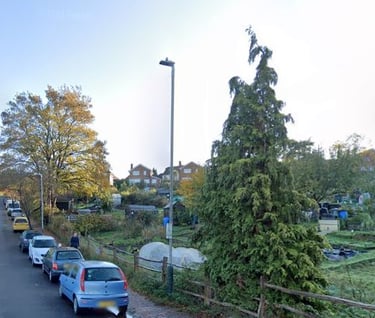
Those who lived on the Ferndale Park Estate in the 1930s, 1940s, 1950s and 1960s will know Pig’s Hill, whereas those who lived there since know it as King George V Hill. Here are some memories and information about the hill.
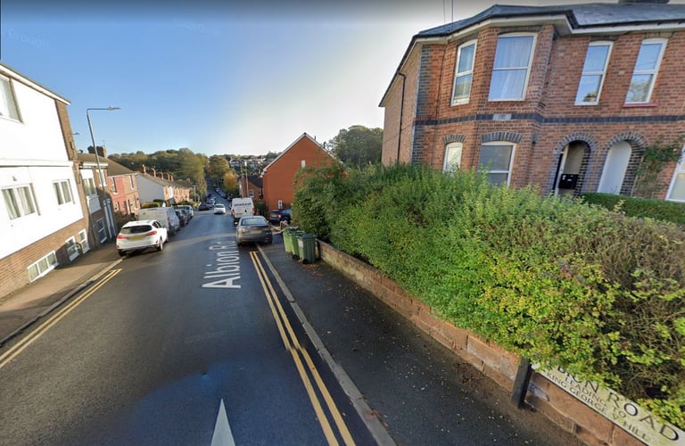
Above: Present day King George V Hill (known locally as Pig’s Hill) and below the original Pig’s Hill, Albion Road from St James Road down to Dorking Road – photo thanks Google Street View.
I was brought up with my friends on the estate to believe that Pig’s Hill was the hill between Dorking Road at the bottom and Hilbert Road at the top, and that is how we always referred to it. Then, in 2016, Clive Stace (104 Ravenswood Avenue) told me, “In quoting ‘Pig’s Hill’ you have perpetuated an error that we all made. Pig’s Hill was in reality the hill from Dorking Road up to Albion Road (as it is now signed), not the one from Dorking Road up to the Avenue. Clive’s comments caused me to research the hill and I find there have been differences of opinion about both the location of Pig’s Hill and the origin of its name.
Clive said, “The latter was a rough track when I was young, and only ‘made up’ in 1947 by Italian prisoners of war. I remember throwing snowballs at them in the long bitter winter of 1946-7. Someone who can vouch for the correct application of Pig’s Hill is my step-mother, aged 90, who still lives in 104 Ravenswood Avenue. She grew up in Dorking Road. Buses went up to the estate soon after the road was completed and now they go right round Ravenswood Avenue.”
Clive was right because the first mention I have been able to find of Pig’s Hill is long before the Ferndale Park Estate existed, in the 21 December 1900 Courier that reported the court case of George Nightingale, licensee of the Mitre public house (now the Allotment Pub), St James Road, on the corner of Western Road, charged with selling intoxicating liquor to a drunken person, Isabella Phillips who lodged with Mrs Turner at St James’ Park. Mrs Turner told the court that throughout the day Mrs Phillips kept constantly going out and bringing back whiskey in a bottle, which she drank neat. Mrs Phillips left her house about 9pm and she followed her up Pig’s Hill and saw her go into the Mitre Inn. She could not walk straight.
The Bench asked, ‘What is Pig’s Hill?’ and the Chief Constable replied, ‘That is what they call Lower Albion Road.’ Mrs Turner then said Mrs Phillips, after coming out of the Mitre, went down Pig’s Hill to her house.
It would therefore appear that in 1900, that part of Albion Road between St James Road and Dorking Road was known as Lower Albion Road, and locally as Pig’s Hill.
This is confirmed by a letter in the Courier the following year on 8 October from ‘One of the Disgusted Inhabitants’. The letter read, ‘We ask, through your paper, is it fair and just towards us inhabitants of Dorking Road that we, as ratepayers as well, should still have such an awful footpath known as Pig’s Hill. Lower Albion Road is now, and has been, nothing but rolling stones to walk on for years...There are stones kicking about now that we have not trodden down, might have been picked up and saved us many times a scramble to keep on our feat...Take the top of Pig’s Hill to start with, a mail cart, no other way, fall down. Then the obstruction at the bottom, in the bushes you go, and yet having no entrance to Dorking Road...’ By the way, after more evidence, the Bench dismissed the case against George Nightingale!
The 29 October 1937 Courier, reporting the Tunbridge Wells Town Council meeting the previous Wednesday, said, ‘The Borough Surveyor laid before the Works Committee a plan showing the construction of a new road from Lower Albion Road to Hilbert Road making provision for a carriageway of 18ft, Councillor Crabtree moved that the matter be referred back and two footpaths of 7ft, and two 4ft grass verges at an estimated cost of £2463, and the Finance Committee were requested to authorise the Works Committee to make the expenditure from revenue. Councillor Crabtree moved that the matter be referred back’, and said the Works Committee had received letters from a number of people complaining of the gradient. He said, ‘Some portions of the original proposed 1 in 10 gradient had been changed to 1 in 7 running into another road of approximately 1 in 5, which would make it very dangerous.’ After a discussion in which it was said a £700 saving could be made if the work proceeded at once, and Alderman Weekes said, ‘The average gradient of Pig’s Hill was 9.7 and the proposed new road was 9.5. There was only a short piece that was steep’, Councillor Crabtree’s amendment was lost.
The Albion Road hill between Dorking Road and St James Road was still being referred to as Pig’s Hill as late as 1944 when the 12 May Courier reported a court case of a man prosecuted for driving his three-wheel van without due care and attention after it collided with a dust-cart. The court was told the dust cart was being driven in St James’s Road towards Albion Road and as it reached the junction, it was struck in the rear by the van ‘coming up Pig’s Hill’.
The first mention I can find of the hill between Dorking Road up to the Ferndale Park Estate being called King George V Hill was in a 3 October 1941 Courier report of a Tunbridge Wells Town Council meeting the previous week, that said, ‘The Allotments Committee considered the petition signed by 113 ratepayers and residents of the Ferndale Park Estate (laid before the Council at its last meeting), asking the Council to reconsider the decision to close the footpath across the Charity Farm allotments. The Committee adhered to its previous resolution to close the footpath. Questions relating to the condition of the footpath on the NE side of the King George V Hill leading to the Ferndale Park Estate were considered, and it was decided that in order to assist the residents on the Ferndale Park Estate the footpath be made an even gradient.’
Despite the Council’s Allotments Committee referring to the hill as King George V Hill, it appears that locally after 1944 the name Pig’s Hill was transferred from the hill between Dorking Road and St James Road to the hill from Dorking Road up to the Ferndale Park Estate.
The hill up to the estate had been made-up by the end of 1947, but confusion over its name continued, because the 19 December 1947 Courier reported a reference to Pig’s Hill under the heading ’Ask the Pigs’ (picture right), that said, ‘What is the name of the eastward extension of Albion Road which runs up to the Ferndale Park Estate, Tunbridge Wells? In a police court case on Monday, it was referred to as King George V Road. On a recent street plan it is King George V Hill. It does not appear as this in Kelly’s 1940 directory and in Town Council minutes it has been referred to as Albion Road. A witness on Monday said, “Pig’s Hill we call it anyway”.’
Possibly because of what the witness said at the court case, the following month the 9 January Courier, under the heading, ‘So it isn’t Pig’s Hill’ (picture right), reported, ‘Tunbridge Wells Council’s Watch Committee has decided that the length of new road connecting Albion Road and Hilbert Road should also be know as Albion Road.’ The Courier was obviously under the impression that ‘Pig’s Hill’ was the hill between Dorking Road and Hilbert Road!
I cannot recall what the road sign for the hill said when I was a child, but I do remember one day after I left the estate in 1963, visiting my parents and seeing a new road sign, King George V Hill, had been erected at the top of the hill, that is still there today. This could well have been about 1968 in view of a letter to the Courier published in its 3 May edition under the heading ‘Names from the Past’ from Dorothy Sherlock of 13 Ferndale. The letter read, ‘When I was a little girl I lived with my grandmother in St James’ Road. She used to take me for walks to the theatre of the Opera House, now alas defunct as such. One thing she, a Kentish woman, told me as we descended the steep slope of Albion Road and prepared for the ascent to Ferndale (there was a farm on our left and the house is still there) was that the hill we were to climb was called Pig’s Hill and the farm was “Been’s Charity farm.” Why, she did not know. I’ve always called the hill Pig’s Hill, but have been told that it has a name now, King George V Hill. I’ve not seen it, being a semi-invalid, but am so sorry the old name has gone. Why? It’s a pity to hear that old ideas and sayings are going.’
It therefore appears that in 1941 the hill was called King George V Hill, at least by the town’s Allotments Committee, then in 1948, referring to it only as ‘the length of new road connecting Albion Road and Hilbert Road’ the Watch Committee decided it, ‘should also be known as Albion Road.’ Finally, about 1968, it was officially renamed King George V Hill and is how it has appeared on road maps ever since.
As late as 1996, Pig’s Hill was still being discussed in the Courier. The 12 July edition published a letter from J Borer of Auckland Road referring to another letter from Mr C Perry about the Council changing the name of a road, and said, ‘...I can’t understand why TWBC has to alter road names. The same applies to this area, namely King George V Hill. Most people know that this is the continuation of Albion Road, but everyone knows it as Pig’s Hill, even people outside the Borough. My brother used to have an allotment on the Charity Farm plot and ordered a load of manure from a farm in Frant. On being asked where it was to be delivered, he said King George V Hill. The farmer immediately said, “Oh, Pig’s Hill.”
‘Incidentally, it acquired this name as years ago pigs were driven down the hill to market from Charity Farm, so I don’t think that it will make any difference if TWBC try to change road names. They will always be known by their original names. I wonder why they have to do this? I quite agree with Mr Perry that it is part of the history of Tunbridge Wells. Is a bit of snobbery involved here? I hope not.’
This picture of houses in Albion Road was published on the Facebook OTW page in October 2017 by Mick White, who said, ‘Seen on eBay. Listed as “1905 Real Photograph Postcard, Children Playing on a Tunbridge Wells Street”. The question was what street and it has been answered. Thanks for the help, it's fair to say these houses are in fact on Albion Road and King George V Hill starts at the bottom of the dip, but to me and many others this area was known as Pig’s Hill’.
Mel Wickenden said, ‘Albion Road runs from the bottom of Camden Road to Dorking Road. King George V Hill runs from Dorking Road to Hilbert Road. King George V Hill is also known as Pig’s Hill. This is where the allotments currently are. Many years ago the area where the allotments are used to be a pig farm, and hence the term “Pig’s Hill”. Hope this clarifies things for you.’
Writing on Facebook OTWPS in 2018, David Smith, said, ‘Pig’s Hill aka King George V Hill. I remember my Dad telling me that pigs were kept there by Pick Bros the butchers at the corner of Wood Street and Camden Road. The name was still be incised in the stone panel under the main shop window. Or was it “Pick's Hill”?’
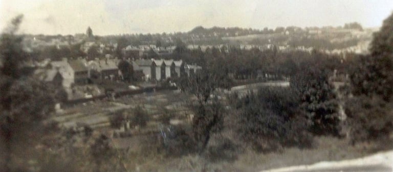
Pictured above right is the view from the front bedroom of 20 Hilbert Road in 1935-36, across the Charity Farm allotments to the houses in Dorking Road with the steeple of St John’s Church on the skyline, from Patricia Skittrall nee Tayler (20 [now 42] Hilbert Road). Pat said, ‘Our house was right at the top of the hill, near the corner with Ravenswood Avenue. so had an extra bit of front garden and room at the side for a garage. There was no bus service then; the way to town was along Ferndale and Lansdowne Road. We used to think it fun to creep through the shrubberies of the big houses in Ferndale hoping they wouldn’t see us. The hill in front of our house (the way to some local shops) was just a steep wide sandy track, all rough sand, stones and gullies and difficult to walk on, especially when wet. I didn’t know then it was prisoners who made the road up but I remember it being done.’


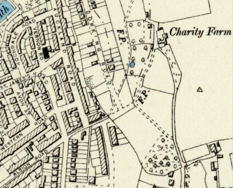

A map c1900 showing an unmade part of Albion Road between Auckland Road and Dorking Road. Only some of the houses in Dorking Road have been built and none at all at the Albion Road end. The map also shows the footpath from the north-east end of Albion Road to Charity Farm referred to in a 1941 Courier in the text left.
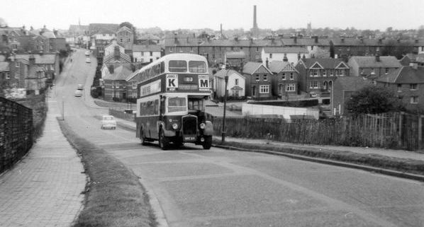

This picture, also shown on the Home page, of the number 83 bus going up what we called Pig’s Hill, clearly shows the new road, footpath and verges referred to in the 1937 Courier report (text left). The original Pig’s Hill of Albion Road from Dorking Road up to St James Road is clearly shown behind. Note the general absence of cars compared with today! – photo thanks John Tippey, Facebook OTWPS.
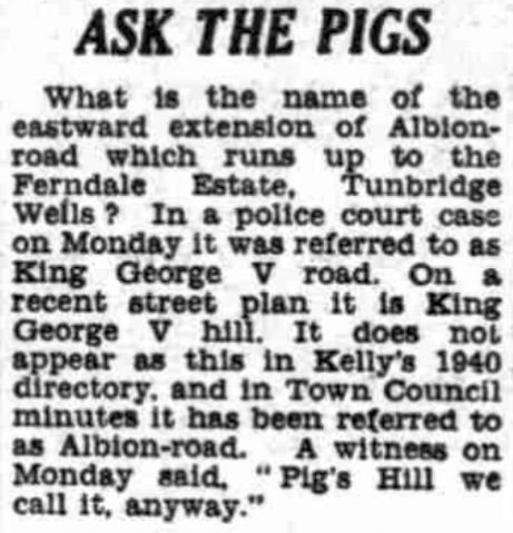

Extract from the 19 December 1947 Courier.
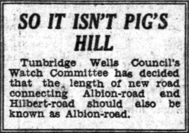

Extract from the 9 January 1948 Courier.
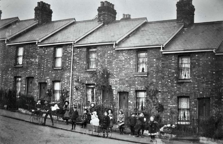

This picture of houses in Albion Road was published on the Facebook OTW page in October 2017, see text left – photo thanks Mick White, Facebook OTWPS.
The view from the front bedroom of 20 Hilbert Road in 1935-36, across the Charity Farm allotments to the houses in Dorking Road, with the steeple of St John’s Church on the skyline – photo thanks Patricia Skittrall nee Tayler.
