Street Directories
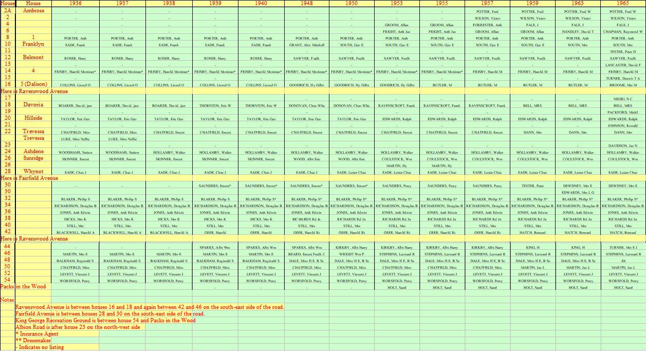
The entries in the spreadsheet below have been taken from the Kellys Street Directory for Tunbridge Wells for the years shown.
The spreadsheet (in xls format) can be downloaded

The 1939 Register
Hilbert Road, Tunbridge Wells, Kent TN2 3SA and TN2 3SB
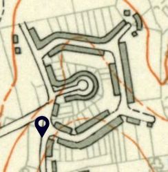

Map of Ferndale Park Estate showing the location (black arrowed) of Hilbert Road, and the gaps in building (dark grey areas) on the estate at that time.






House Re-numbering
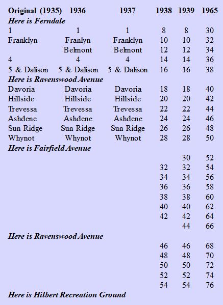
The house numbers in Hilbert Road were re-numbered sometime before the 1965 Kellys Street Directory was published, probably as a result of the newer houses (present day numbers 11-23) being built on the west side of Hilbert Road opposite numbers 8-16, and this can lead to confusion when comparing older records with new ones. If anyone knows exactly when the re-numbering was done, then please let me know. To help relate today’s house numbers with those shown in the street directories and the 1939 Register, I have compiled the table on the right showing the re-numbering between the 1939 and 1965 columns. I believe the re-numbering in the table is correct, but if you know different then, again, please let me know.
This was not the first time the houses in Hilbert Road were re-numbered! When the first houses were built on the east side of Hilbert Road in 1934, starting at the Ferndale end, the 1935 and 1936 editions of the Kellys Street Directory shows the first five houses, up to the junction with Ravenswood Avenue (present day 30-38), were either numbered (30 and 36) or named (32 and 34), or both (38). The first renumbering took place between the 1937 and 1938 editions of the Kellys Street Directory when the first five houses were re-numbered 8-16, and is how they remained until the 1965 directory by when they had been numbered. It appears that after the first 11 houses were built in Hilbert Road (up to Fairfield Avenue), they were initially named, as shown in the 1936 and 1937 columns. I have included the names in the table for completeness. The same thing happened with the first houses that were built in Ravenswood Avenue, and I will write more about this in the section on the history of the house building on the estate.
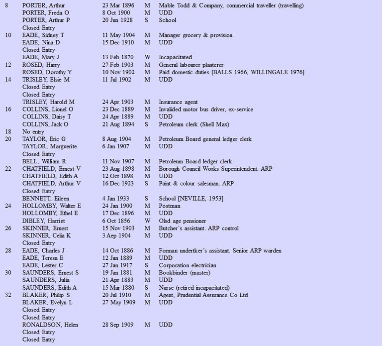
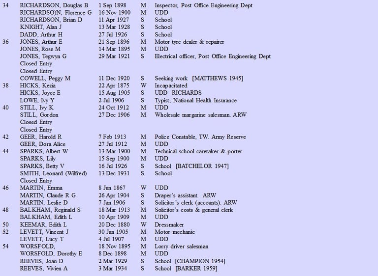
The entries in the text file below have been taken from the 1939 Register. The Register was taken on 29 September 1939 and is one of the most important twentieth century genealogical resources for England and Wales. The 1931 census was destroyed by fire. No census was taken in 1941 because of the war. So the 1939 Register is the only national census-like resource available for this period. Once war became inevitable the British Government knew they had to issue National Identity cards. They planned for the wide-scale mobilisation of the population and the eventual introduction of rationing. The most recent census was now almost a decade old, so more up-to-date statistics were needed. Some preparations had already begun for the 1941 census, so the Government capitalised on this to take a register of the civilian population. They issued Identity cards immediately afterwards (which were used until 1952). The Government constantly updated and changed the 1939 Register over time to take account of changes of address or deaths. When they introduced rationing in 1941, they planned it with information from the 1939 Register. The 1939 Register eventually formed the basis of the NHS registration system.
The text file (in doc format) can be downloaded
The four columns show the house number (or name), occupiers name (later additions in brackets), occupiers date of birth, Married (M), (Single (S) or Widowed (W) and occupation. A name in square brackets in the occupation column for women indicates a change of surname on marriage, sometimes showing the year of marriage. A ‘Closed Entry’ indicates the record is closed for a century after the person’s birth (the 100 year rule), unless it can be proven they passed away before this milestone.
Abbreviations are commonly used in the Register as follows:
AFS Auxillary Fire Service) ARP Air Raid Precautions Warden ARW Air Raid Warden GPO General Post Office RNVSR Royal Navy Volunteer Supplementary Reserve
TW Tunbridge Wells UDD Unpaid domestic duties (used for women not working and looking after the home) WVS Womens Voluntary Service
Some house numbers are missing. This is because the houses had not been built by September 1939. In fact there are no records at all for Pinewood Road. The maps for the other four roads show where the gaps in building were located.
It is interesting to note the different occupations of the persons living on the estate. There were 11 police officers and three retired police officers, and I know of at least two other police officer who moved to the estate the following year. The size of Tunbridge Wells Borough Police in 1939 was only about 40 officers, which means over a quarter of them lived on the estate. It must have been a very law-abiding place to live!

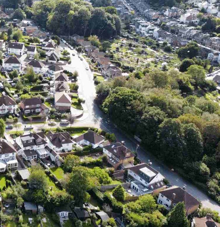

A recent picture of Hilbert Road from the air – photo thanks Zooplah.
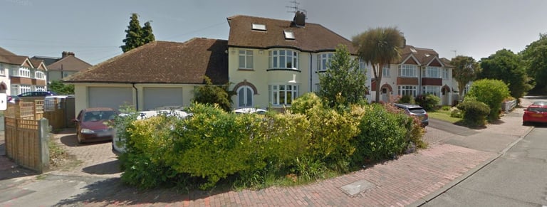
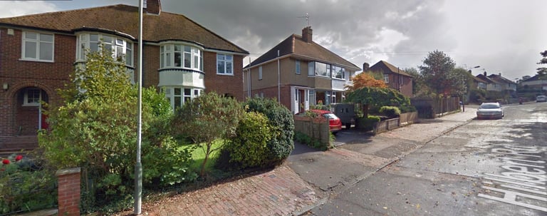
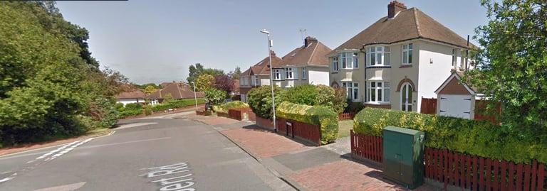
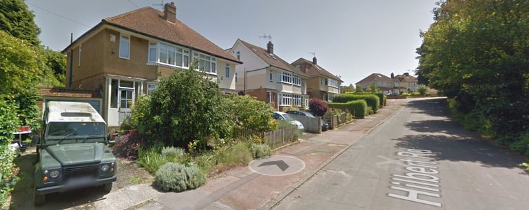
Recent pictures of Hilbert Road: (top left) looking up Hilbert Road from number 76 at the bottom by the entrance to Hilbert Recreation Ground; (top right) looking up Hilbert Road from numbers 62 and 64 by the junction with Ravenswood Avenue; (middle left) looking down Hilbert Road from the junction with King George V Hill and (bottom left) looking along the top part of Hilbert Road from number 38 by the top junction with Ravenswood Avenue. Do you have any old pictures of Hilbert Road that you would allow me to display here, please?